THE INDIANS OF ROBESON COUNTY NORTH CAROLINA
AND
HANCOCK COUNTY TENEESSEE
"An old Indian" George Lowery/Lowrie, made an address at the funeral [atteneded by whites and Indians] of his kinsmen killed by the Confederates in 1864.
Quoted in Lost Colony of Roanoke by Hamilton McMillan, George Lowery said;
"We have always been the friends of the white men. We were a free people long before the white men came to our land. Our tribe lived on Roanoke, in Virginia."

- The 1646 act required Abraham Wood to keep 10 men at the old fort. It was, at the time, on the southwestern edge of colonial settlement in Virginia. Wood had few local customers, and ships sailing up the James River could load cargoes and sell their imported goods long before reaching the Fall Line on the Appomattox River. Wood himself had a plantation on Upper Chippokes Creek,
- Indians on the Upper Chippokes Creek:
William Knott, 312 Acres, Surry Co 28 Mar 1666, p. 482 (land patents). 112 acres on south side of James River on south side of Upper Chipoakes Creek, bounded NW on land of Edward Oliver, N upon Wm. Thomas, E on George Gibson [See Indian Jane Gibson of Charles City County] SE on Mr. Fisher; 200 acres on south side of said River, Wly. on Jeremiah Clements, NW on Edward Oliver, Nly on Wm. Thomas, George Gibson & Edward Minter, Ely. on Wm. Gapins land & Mr. Thomas Busbie [Interpreter for the Crown] and SE on Mr. Richard Hill
The Quiyoughcohannock were one of the first Virginia Indian groups the English encountered in 1607 after landing at Jamestown. Situated primarily in present-day Surry County, the Quiyoughcohannocks had four villages in the region likely east of Upper Chippokes Creek
The Expedition of Batts and Fallam:
''Sept. 5. Just as we were ready to take horse and march from the Sapiny’s about seven of the clock in the Morning we heard some guns go off from the other side of the River. They were seven Apomatack Indians sent by Major General Wood to accompany us in our voyage. We hence sent back a horse belonging to Mr. Thomas Wood, which was hired, by a Portugal, belonging to Major General Wood, whom we here found. About eleven of the clock we set forward and that night came to the town of the Hanathaskies which we judge to be twenty five miles from the Sapenys, they are lying west and by north in an island on the Sapony River rich land. '
- A Journey from Virginia to beyond the Appalachian Mountains, September, 1671
''Sept. 5. Just as we were ready to take horse and march from the Sapiny’s about seven of the clock in the Morning we heard some guns go off from the other side of the River. They were seven Apomatack Indians sent by Major General Wood to accompany us in our voyage. We hence sent back a horse belonging to Mr. Thomas Wood, which was hired, by a Portugal, belonging to Major General Wood, whom we here found. About eleven of the clock we set forward and that night came to the town of the Hanathaskies which we judge to be twenty five miles from the Sapenys, they are lying west and by north in an island on the Sapony River rich land. '
- English explorer Edward Bland wrote in 1650 about the "Occononacheans and Nessoneicks" living on Roanoke River. The "Nessoneicks" were Saponi.[16] In 1670, John Lederer visited what he described as "Sapon, a Village of the Nahyssans," who were the Saponi.[16] Lederer wrote about the Saponi: "The nation is governed by an absolute Monarch; the People of a high stature, warlike and rich."[16]
- In 1671 Thomas Batts and Robert Fallam led an expedition that passed through several Saponi villages. After their visit, the Saponi and Tutelo moved downriver and settled with Occaneechi people. Wikipedia

"We have always been the friends of the white men. We were a free people long before the white men came to our land. Our tribe lived on Roanoke, in Virginia."-George Lowery
Herbert 1725 Map
Saura/Cheraw Village on the Pee Dee
[Spenser Bolton born 1735 on the Pee Dee according to his
Saura/Cheraw Village on the Pee Dee
[Spenser Bolton born 1735 on the Pee Dee according to his
Revolutionary Pension Application -testimony proved they
were known as Portuguese and called Melungeons.]
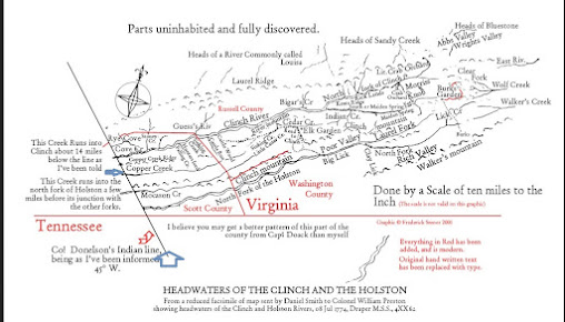
 Maps are Great!